My research interests lie in the reconstruction of ice sheets, and how they influence and interact with the landscape, environment and subsurface.
As well as the iC3 Centre of Excellence, my research contributes to the (ERC) Synergy Grant i2B- Into The Blue
Sailing through sea ice in the northern Barents Sea (Credit: Henry Patton)
Some recent publications
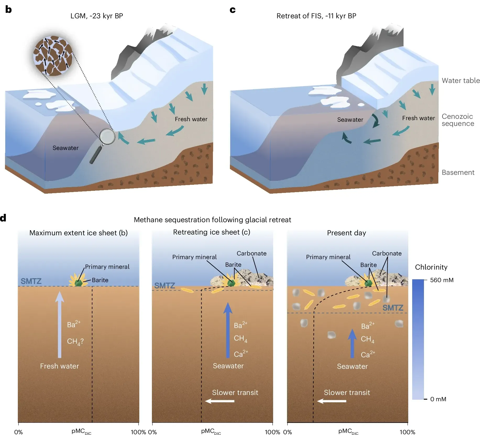
Deglaciation drove seawater infiltration and slowed submarine groundwater discharge
(Nature Geoscience, 2025)

Glacial erosion and Quaternary landscape development of the Eurasian Arctic
(Earth-Science Reviews, 2024)

Geological and glaciological controls of 21,700 active methane seeps in the northern Norwegian Barents sea
(Frontiers in Earth Science, 2024)
Sometimes I create interactive maps…

ICEMAP
An interactive reconstruction of the Eurasian ice sheet and its erosion potential during the last ice age

Map myths
‘Map myths’ delves into the tales behind the cartographic myths, blunders and imaginations that shaped our view of the world during past centuries.
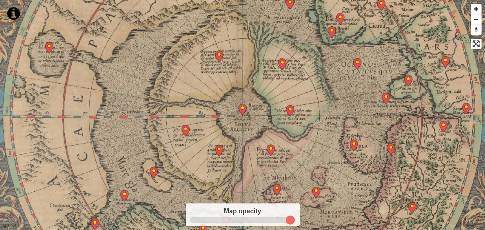
Mercator’s view of the Arctic
In 1595 the Arctic was a vast unknown and full of mystery. Explore this interactive map prepared by the famous cartographer, Mercator – the first dedicated view of the Arctic from the golden age of cartography.

How the Arctic was discovered
An interactive history through four centuries of exploration for the Northwest and Northeast Passages.